NWS graphic
The potential for severe weather is expected to hit the Carter and Ripley counties areas by around 1 p.m. according to the National Weather Service.
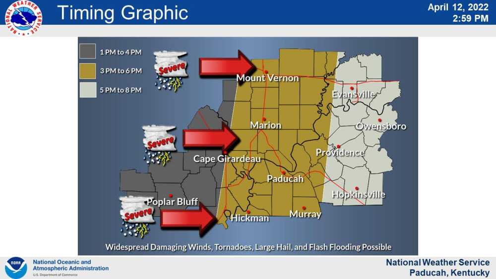
A significant storm system is expected to cross Southeast Missouri between 1-4 p.m. today, said Greg Meffert, NWS lead forecaster. Carter and Ripley counties sit at the farthest west area of the Paducah, Kentucky, office’s region and will see impacts first, he said.
The system may reach Butler County by around 2 p.m., according to current forecast predictions.
“There’s the potential for all types of severe weather, whether it be damaging wind gusts, large hail and even a couple tornadoes,” said Meffert. “The good news is the window is fairly short. In any one spot, the threats probably going to be an hour or so.”
Damaging winds of 60 to 70 mph winds or higher, large hail up to two inches, and tornadoes are all possible, the NWS has reported. Widespread damaging straight-line winds are expected.
Meffert also warned of torrential downpours during this timeframe and the threat of localized flash flooding.
A wind advisory is also in effect for wind gusts up to 40 mph outside of storms through 7 p.m., according to the NWS.
The Storm Prediction Center has the entire area at a Moderate Risk of Severe Weather.
