National Weather Graphic
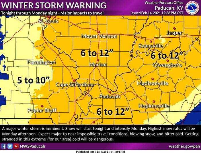
A winter storm warning is set to take effect for the area at 6 p.m.
The National Weather Service reports snow accumulations of six to 12 inches are possible for the region.
The heaviest snowfall will be on Monday.
“Travel conditions will become extremely dangerous tonight and Monday. Commutes Monday morning, Monday evening, and Tuesday morning will be impacted,” The NWS reports.
The Missouri Department of Transportation has urged residents to get where they need to be ahead of the storm and avoid traveling after that.
“This snowfall will again be accompanied by dangerously cold temperatures,” MoDOT reports. “If you must travel during the storm, make sure to have a full tank of gas, extra blankets and gloves, and provisions like water and snacks in the event of an emergency. Keep your cell phone charged, but do not use it while driving. In the event of a crash, stay buckled inside your vehicle until help arrives.”
Another storm is taking aim on the area later Wednesday through Thursday, meteorologists have said. As a result, impacts may last through the end of the work week.
“A potential winter storm late Wednesday into Thursday night could bring significant amounts of wintry precipitation to all or portions of our region,” according to the NWS.
